|
Report
on the Whangie
Sunday 20th February
2004
John suggested a walk to
The Whangie at the club night. I had heard of this strange rock formation
and wanted to see it for myself. The legend has it that the devil was
late for a meeting at a witches' coven, and he went swooping round the
hill in such a hurry that his tail caught and sliced open the hillside.
Apparently Whangie means slice but we think it is because the first person
who discovered it couldn't think of a better name...a bit like thingy.
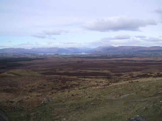
John, Anne and myself set off from Queens View Carpark, which is on the
Milngavie - Drymen Road, at about 10am. It was bitterly cold but with
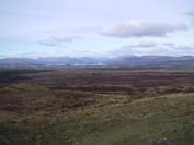
great visibility. The mountains were all snow covered and we could see
for miles. We headed up to the trig point at Auchineden Hill and looked
around for the Whangie. Where was this Whangie? We decided to use this
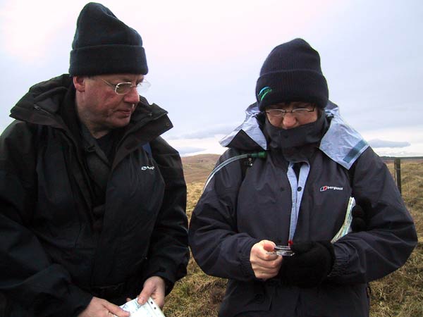
day to practise our navigation skills by using our maps and compasses
and seeing what my GPS could do as the instructions are so complicated.
You know what it's like with gadgets, we haven't got the patience to read
all the instructions, we just want to start pressing the buttons and finding
out for ourselves. Still couldn't find this Whangie, makes you wonder
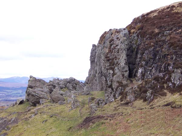
if we could find sand at the seashore! Did we expect this grand rock to
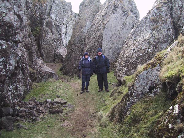
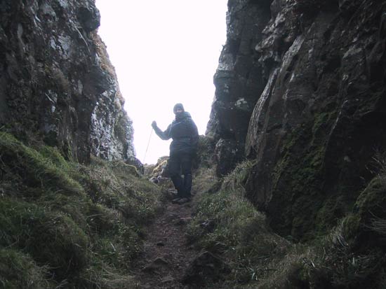
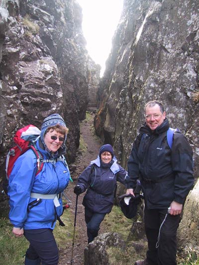
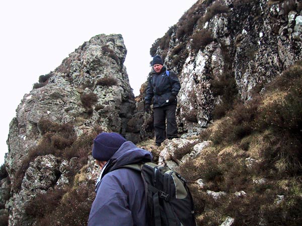
rise up before our eyes? We knew we were near it, then John looked over
the edge from where we were standing, and lo and behold... there is was.
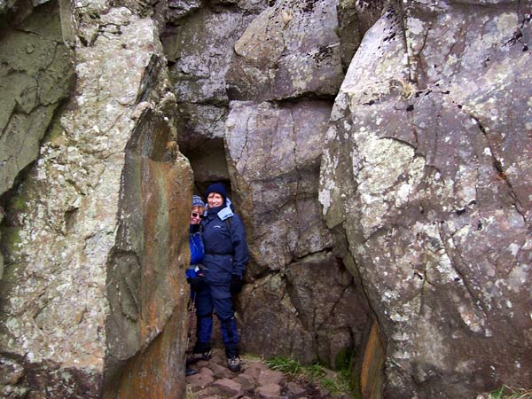
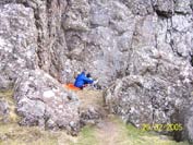
We climbed down and walked through this rock corridor which narrowed at
the far end. There were many large flakes of rock around. It was a spectacular
sight. If only Robin, the club's geologist, was here he could explain
it to us. Good place for lunch as we were sheltered from that icy wind.
One minute we felt we were the only ones there then somebody would pop
up from nowhere...spooky!
We decided to carry on and head for the Burncrooks Reservoir, still practising
our navigation only to be told by 3 people that came up behind us that
they were following us....what a risk they were taking!!! It also made
us feel better when 2 women shouted to us asking where the Whangie was,
so John confidently gave them directions. We headed down to the reservoir
but went over a style 3 times thinking we were going in the wrong direction.
Well not strictly true, Anne went over the style 3 times, we noticed that
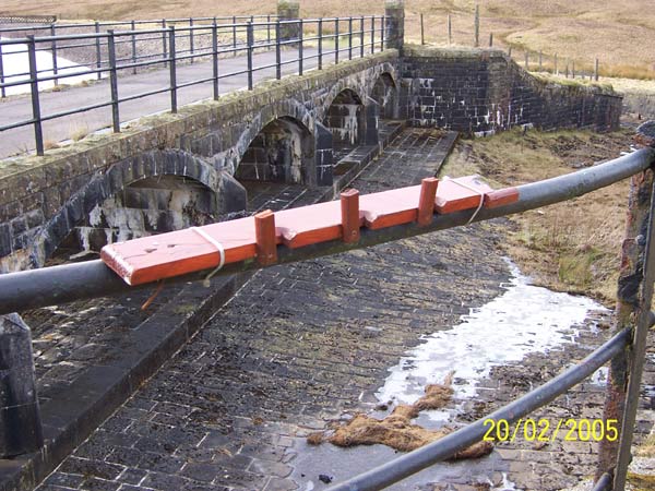
the gate opened. That was time for our second lunch of day. We sat at
the reservoir trying to work out what was the purpose of short wooden
planks with grooves and hinges that were either tied onto a railing or
were free standing. I thought they were for the fishermen to stand their
rods up while they ate lunch and as Anne and John couldn't think of a
better reason my guess won. We then headed round towards a small burn
where the map showed a path on the right hand bank. Path... what path!
We just had to work our way along the hillside and along the edge of the
forest, back the Whangie and trig point then down to the car.
What made the day enjoyable was the fact we were not in a hurry, we had
time to look around at the features and identify them on our maps, we
had time to work out exactly where we were and practise our navigation,
we were not exhausted, the views were superb and the company was excellent.
Quote of the day from Anne.......are satellites up in the sky???
Irene
 |
|
|
|
 |
|
|
|
| |
|
|
|
|